Page 1 of 1
Mapping from my iPad
Posted: Tue Jan 12, 2016 11:42 pm
by Murphangler
Pic I took from my iPad planning a route using the Dock-to-dock autoroute feature on the Navionics app. Travel time and distance for each waypoint on my way from the launch to the lock, so I can see exactly how much time I will have to reach the lock in time. pretty sweet freature that will allow me to have much more efficient practice when I head down to compete in the Southern open #1 on Toho.
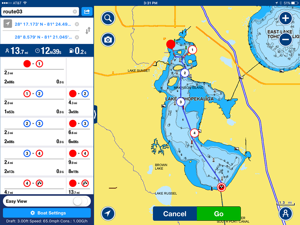
- DTD AR.png (342.45 KiB) Viewed 5352 times
Re: Mapping from my iPad
Posted: Thu Jan 14, 2016 1:07 am
by brendanc
That's a nice feature. So you bring your iPad on the water with you during practice?
Re: Mapping from my iPad
Posted: Thu Jan 14, 2016 9:15 pm
by Murphangler
Brendan I have it mounted to the console using a Ram locking mount. Ill switch between the app and Google maps for aerial views of where I am....and to play Clash of Clans when the fishing is bad.....
Re: Mapping from my iPad
Posted: Fri Feb 12, 2016 6:40 pm
by brendanc
lol... Clash of clans, that's awesome! I like the idea of pulling up the satellite maps on the water. I used to take screen captures of the areas I was going to and stored them on my phone and/pr tablet back when you could access the internet to readily on the water.